
Travelling to these GP practices
We understand that these temporary practice closures have travelling implications for any patients who need face to face appointments. In this section, we have set out some of the public transport and other travel options for Litherland, Thornton and Crossways practices.
Distances, driving and walking times have been generated by Google Maps.
Each section includes a map showing bus travel times. Each colour represents the average length of time it takes to travel to the practice from different places on the map. Travel times include any walking needed as part of the journey, such as from an address to the bus stop, or from a bus stop to the surgery.
There are areas on each of the maps without a colour. This is because it would take longer than 45 minutes to travel to the practice by bus from these areas, or because they are further than 400 metres from a bus stop that serves the practice.
The travel times on the maps also take into account journeys that may be used to get to the practices but would involve changing buses to one of the routes mentioned part way through the trip. These additional bus routes are not shown.
More details of bus routes and timetables can be found on the Merseytravel website www.merseytravel.gov.uk
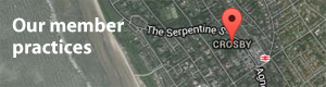
Getting to Litherland Practice
Find out more
Click on the links below to find out more about how you can comment and how to request any support you may need to take part:
<BACK NEXT>
-
Introduction
-
About us
-
Current picture - how your GP practices have been working
-
Why these changes are needed
-
Travelling to these GP practices
-
How to have your say
-
Data protection statement
You can also find all this information in a single downloadable booklet.